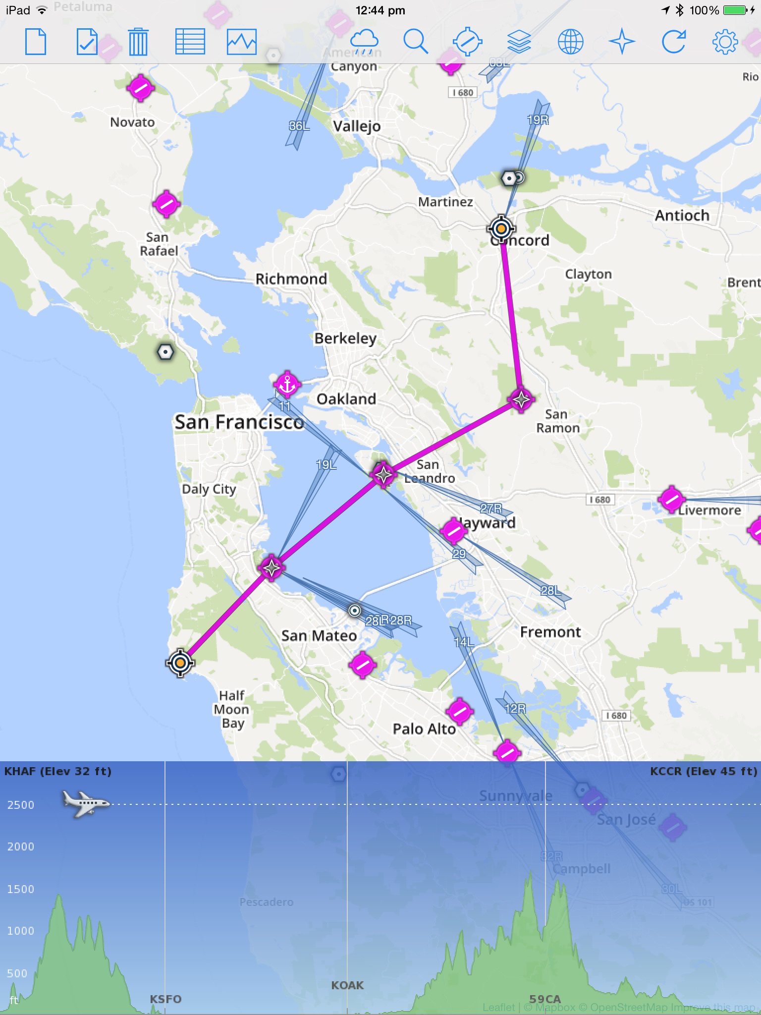
QuickPlan for iPad is a visual touch enabled flight planner that makes it easy to generate flight plans in native FSX, FS2004 or X-Plane formats. It makes a great companion for our moving map app - FSWidgets Navigator.
The entire route is generated visually, by tapping the map to add the departure airport, intermediate waypoints and arrival airport in the same order that you intend flying the plan.
During plan creation and after adding the final arrival waypoint you also have the opportunity to remove any of the intermediate waypoints before saving the plan in your preferred format.
Flight plans are saved to the apps Documents folder, accessible on macOS via the Finder window, or on Windows PC using the iTunes File Sharing feature. For a more convenient file export solution you can use the built-in Dropbox support to easily transfer flight plans to your Mac or PC.
Now includes 40 Aero Chart overlays and Worldwide Nav Data icons (airport, ILS, VOR, NDB, fix).
FEATURE LIST:
- Generates native FSX (.pln), FS2004 (.pln) and X-Plane (.fms) format flight plans
- Saves flight plans to the Documents folder, can be exported/imported
- macOS - Flight plans are accessible on macOS via the Finder window
- Windows PC - Flight plans can be exported via iTunes File Sharing feature
- Includes optional Dropbox support for easy transfer of flight plans to Mac or PC
- Dropbox feature syncs to the folder "Dropbox/Apps/FSWidgets - QuickPlan" on your Mac or PC
- Search for airport by ICAO identifier
- Map powered by Leaflet API (using OpenStreetMap & custom data)
- Includes many world-wide maps styles
- Includes 40 aero chart overlays
- Worldwide Nav Data icons (airport, ILS, VOR, NDB, fix)
- World-wide Metar and TAF Data icons
- US Nexrad (Next-Gen Radar) Data
REQUIREMENTS:
- iPad with iOS 12.0 or later.
- MSFS, FSX, FS2004 or X-Plane.
- Free (or Pro) Dropbox account (if using that feature)
- Dropbox must be installed on Mac or Windows PC
- Wi-Fi network required
- Internet access required, to download map data


